 Barnorama All Fun In The Barn
- 10shares
- 10
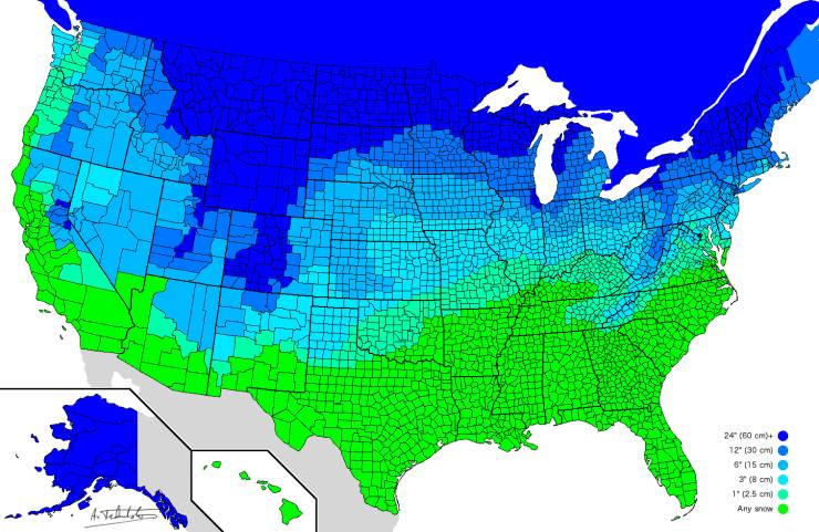
How much snow it takes to cancel school.
“I made a world flag map in Minecraft! Took me all of quarantine.”

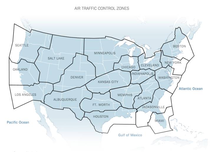
Air Traffic Control Zones in the Contiguous US

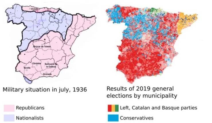
Two maps showing the correlation between areas where the 1936 military coup against the democratic government initially succeeded and the 2019 national Spanish elections. Via @simongerman600 on Twitter.
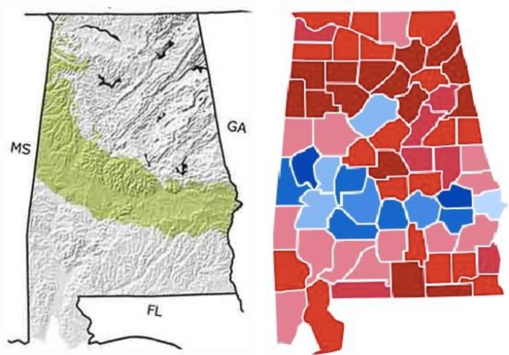
The Cretaceous Period (145 to 66 million years ago) seashore in Alabama vs how Alabama voted in the 2016 election.
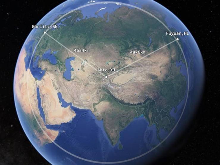
The westernmost point of China is closer to Germany than it is to the easternmost point of China.
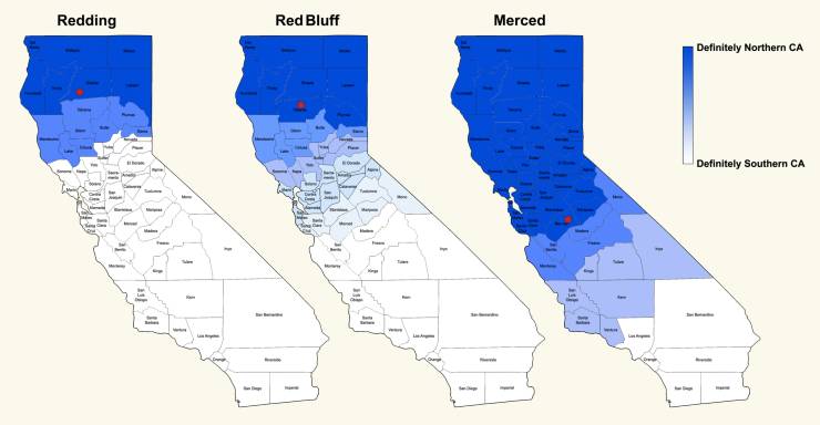
Where Californians think Northern California begins (based off of where they live: Red Bluff, Redding, or Merced)
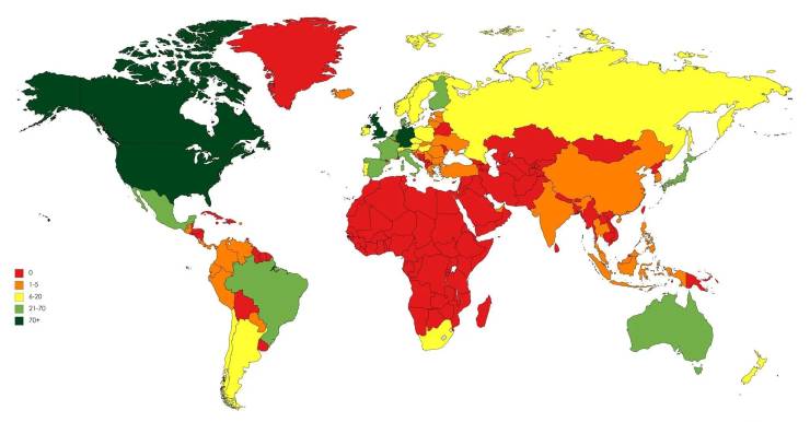
How many times Metallica went to every country.
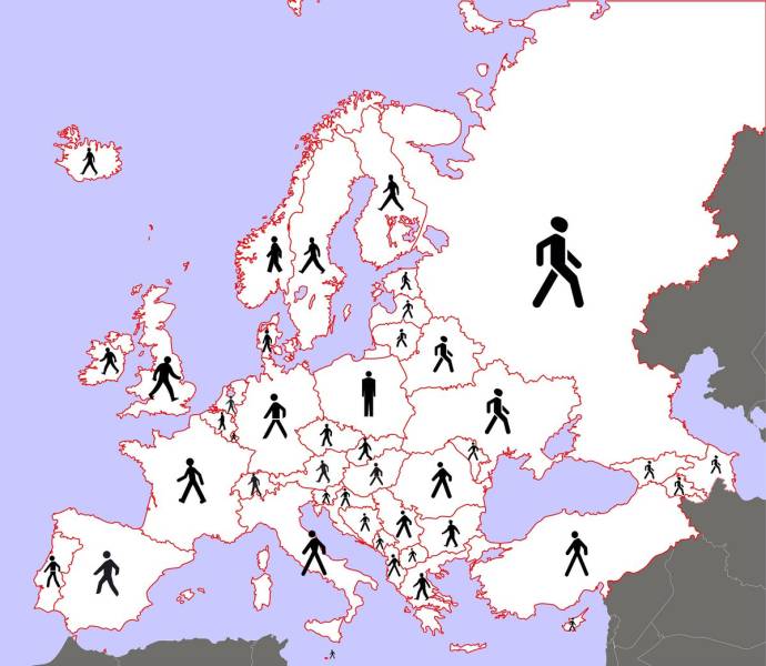
What pedestrans look like across Europe.
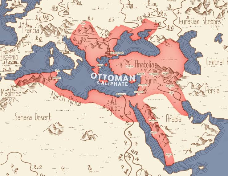
Ottoman Empire at its peak in 1683.
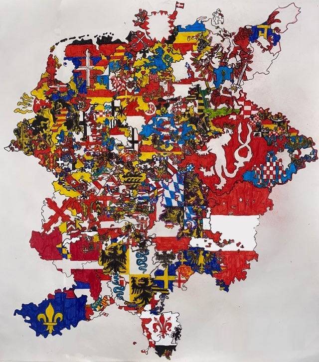
The Holy Roman Empire in 1355
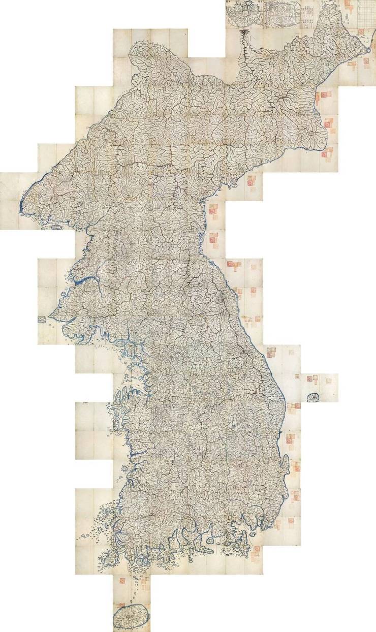
A Cartographer named Kim Jeong-ho walked the entirety of the Korean peninsula through every mountain and valley for years to produce an extremely precise, gigantic map of Korea (대동여지도) in 1861.
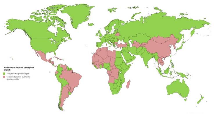
Which countries’ leaders speak english.
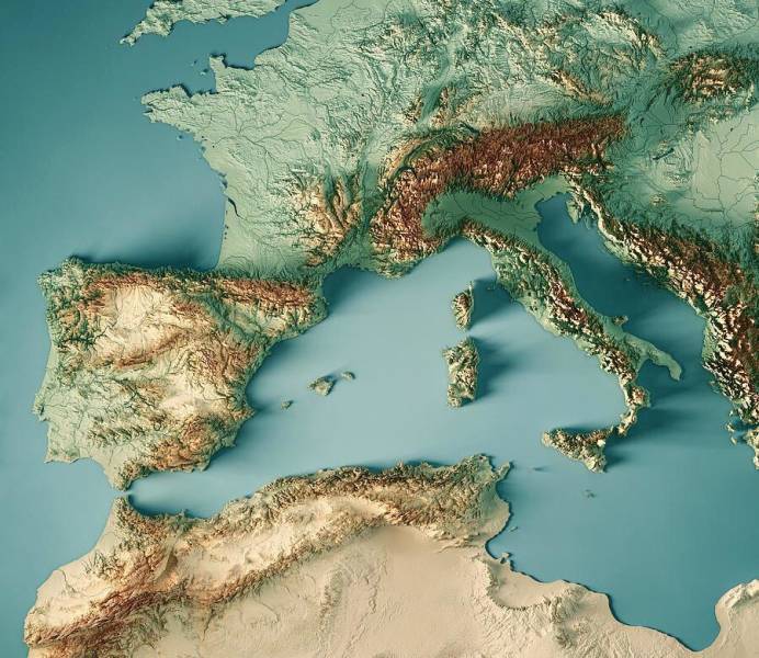
Relief map of south-western Europe.
A map of all the airports in the world, using the plate carrée projection because I am lazy.

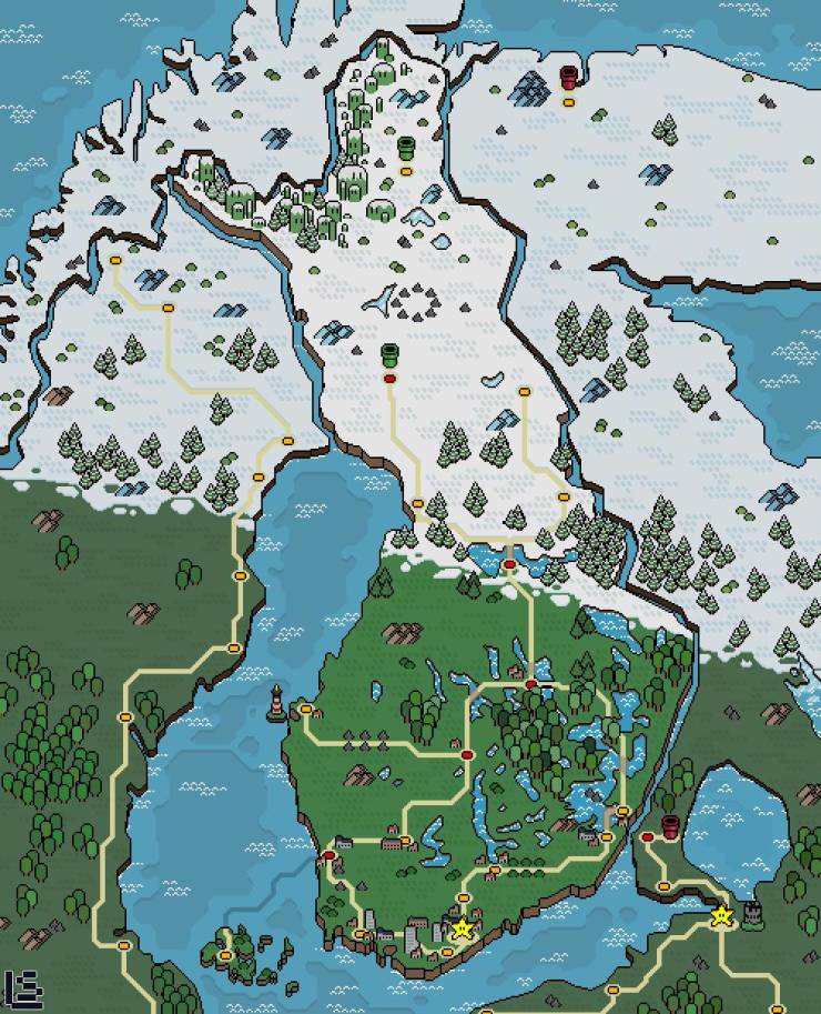
Here’s a map of Finland in the style of Super Mario World !
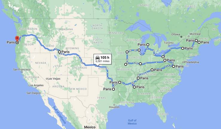
A Tour of Paris — US Edition
3D Rendered Relief Map of California’s 2020 Wildfire Boundaries

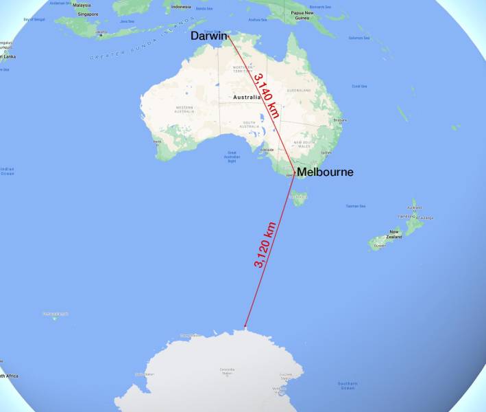
TIL Melbourne is closer to Antarctica than it is to Darwin.
Metal bands per 1 million inhabitants in Latin America.

- 10shares
- 10
#2 i guess quarantine wasn’t long enough because they didn’t give scotland, wales or nborthern ireland flags.