 Barnorama All Fun In The Barn
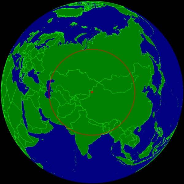
“This is the farthest place on earth from any ocean.”
“Each star represents a Capital City of a country”
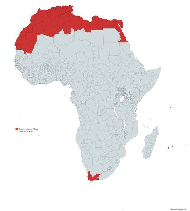
“Non-Black Majority Regions in Africa”
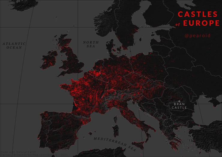
“Map for Halloween – Every Castle in Europe”
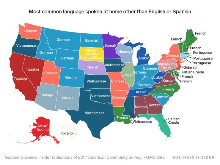
“Most common language spoken at home other than English or Spanish”
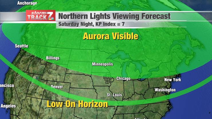
“Tomorrow Night, we will have Aurora Borealis at this time of year, at this time of day, in this part of the country, localized entirely within the area in green on this map. Whether you can see it depends on how far North you are as well as cloudiness.”
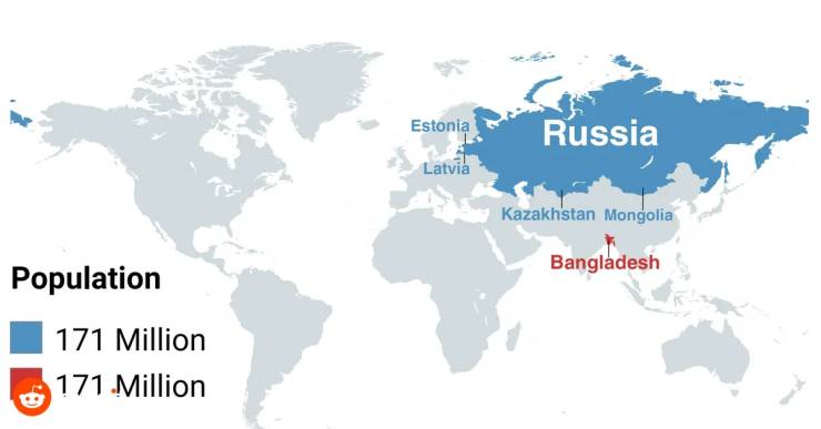
“Population of Bangladesh = Russia + Kazakhstan + Mongolia + Estonia + Latvia”
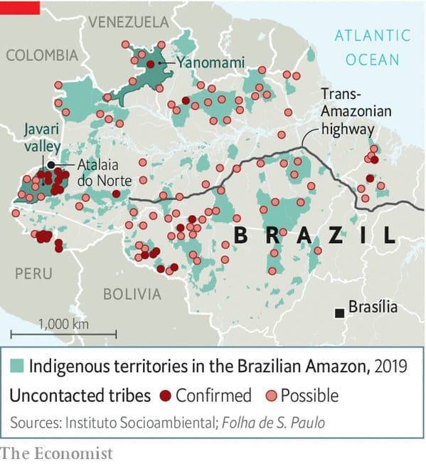
“Uncontacted tribes in the deep Amazon.”
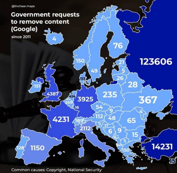
“Government request to remove content (Google) since 2011”
“Government request to remove content (Google) since 2011”
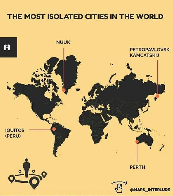
“The most isolated cities in the world”
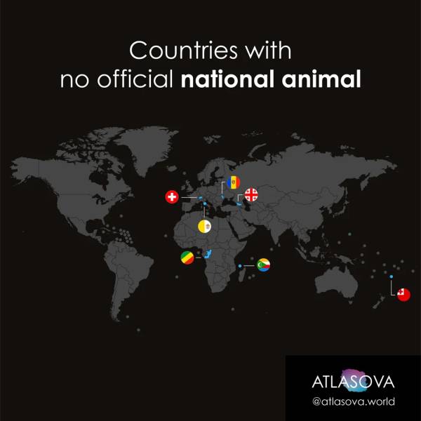
“Countries with no national animal”
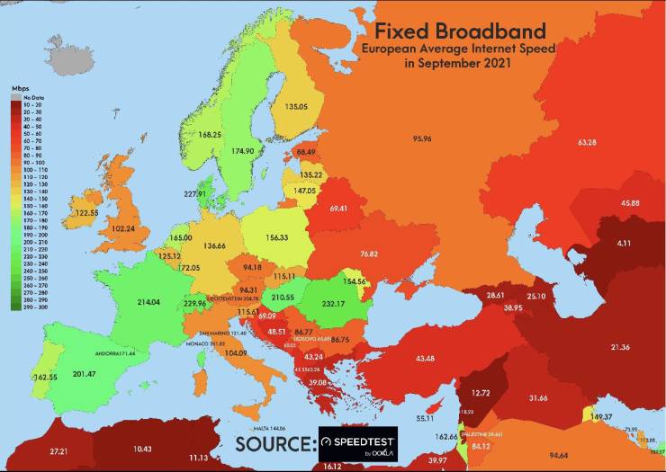
“Average Fixed Internet Speed in european subcontinent as it was in September 2021”
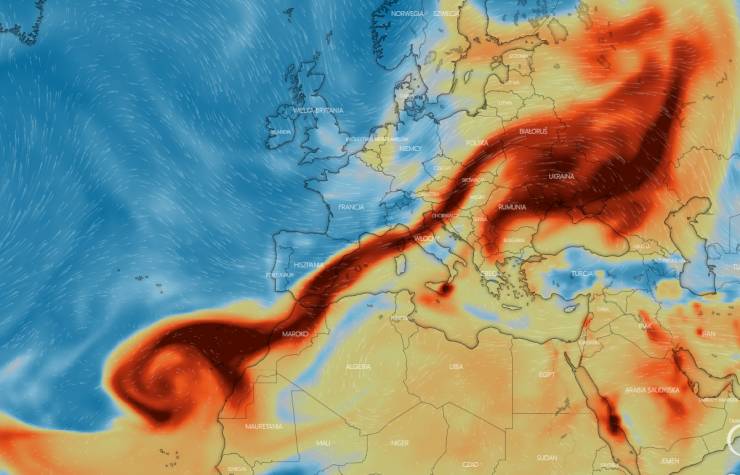
“Poisonous SO₂ in atmosphere over Northern Africa and Europe due to vulcanic eruption on La Palma”
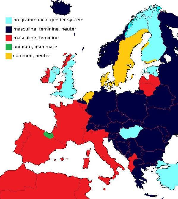
“European languages by grammatical gender treatment (by W. de Melo)”
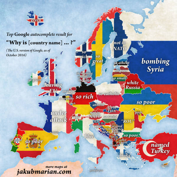
“The U.S.’ Google Searches of European Countries”
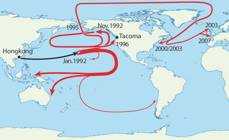
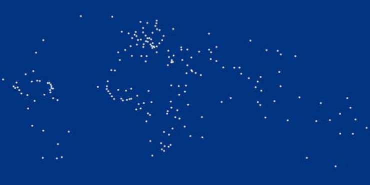
“In January 1992, a cargo ship leaned a little too far, and caused a container holding 29,000 rubber ducks to fall. This is the path those ducks took.”