 Barnorama All Fun In The Barn
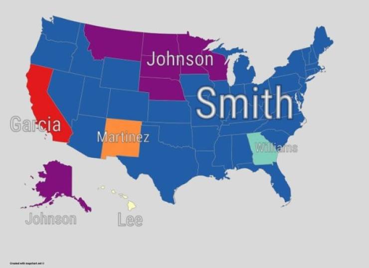
“Most Common Surname In The United States By State”
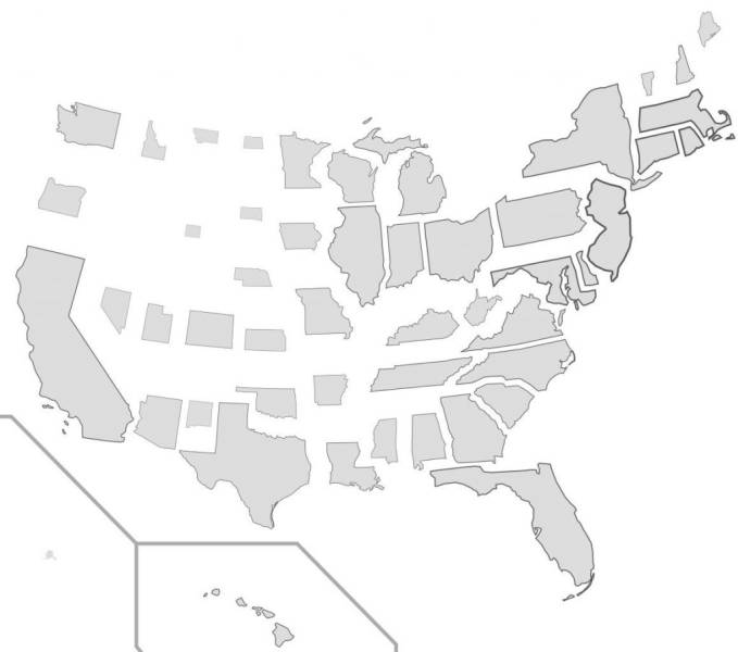
“US States Scaled Proportionally To Population Density”
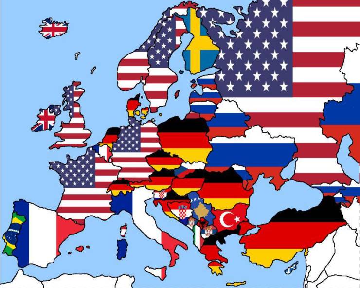
“Most googled countries in Europe (besides their own)”
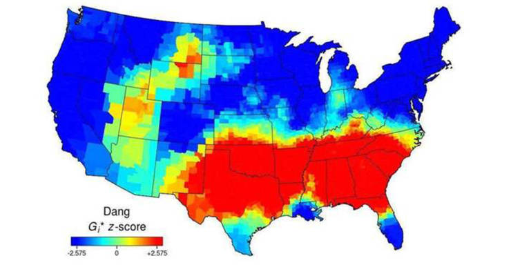
“Use Of The Word “Dang” Across The Continental US”
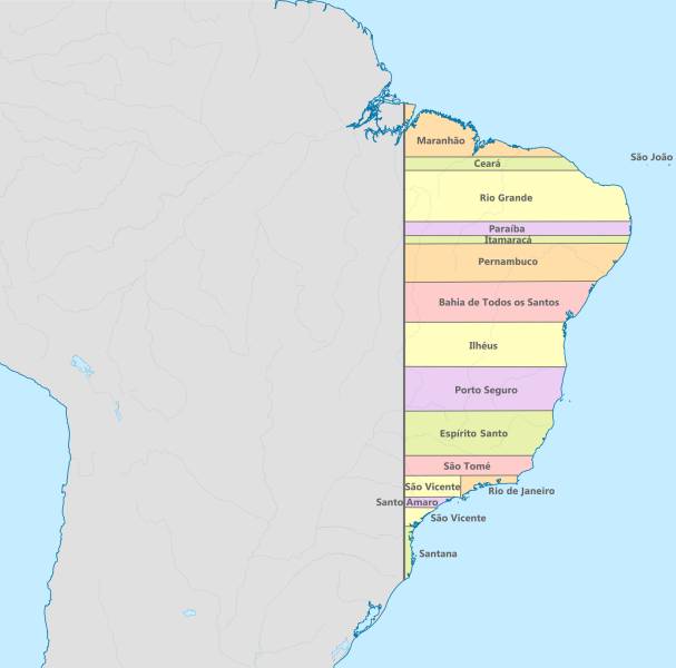
“Brazil had straight borders in 1534.”
“US Governors By Eye Color”
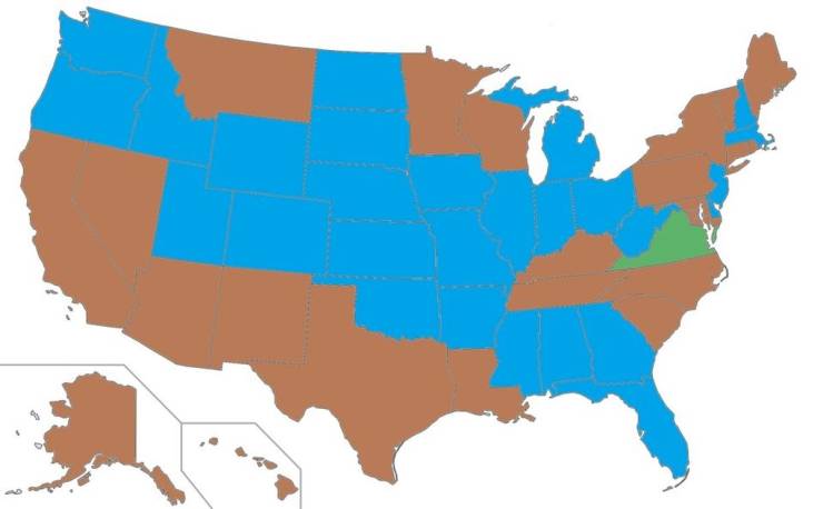
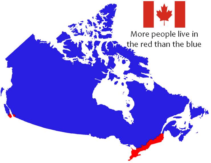
“Where most Canadians live (red)”
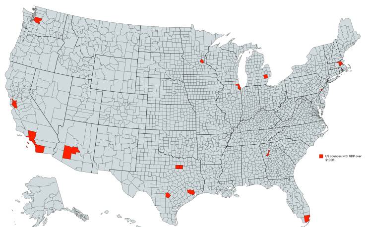
“US Counties With Gdp Over $100b”
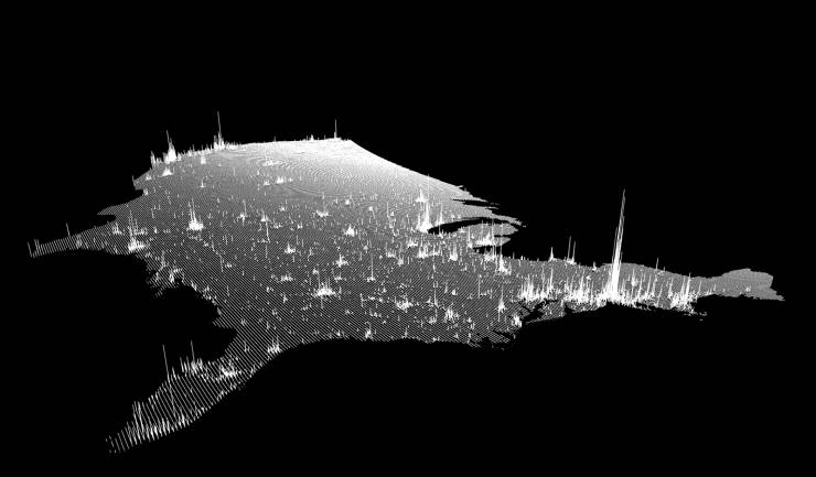
“United States Population Lines”
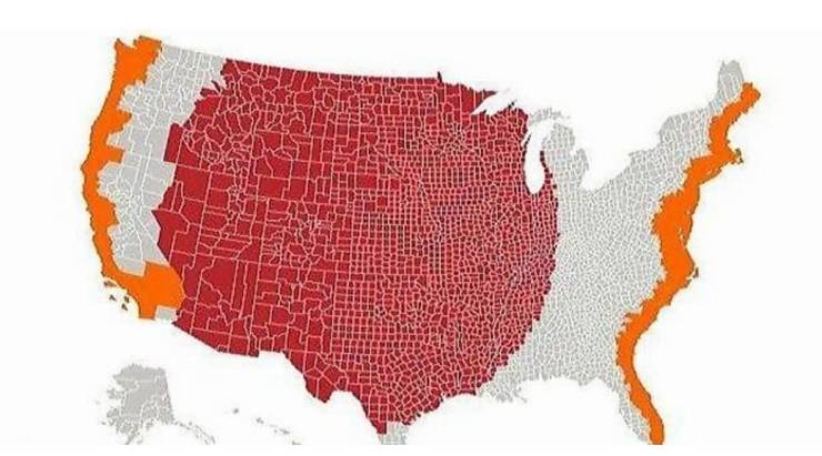
“More People Live Inside The Red Area Than The Grey Area”
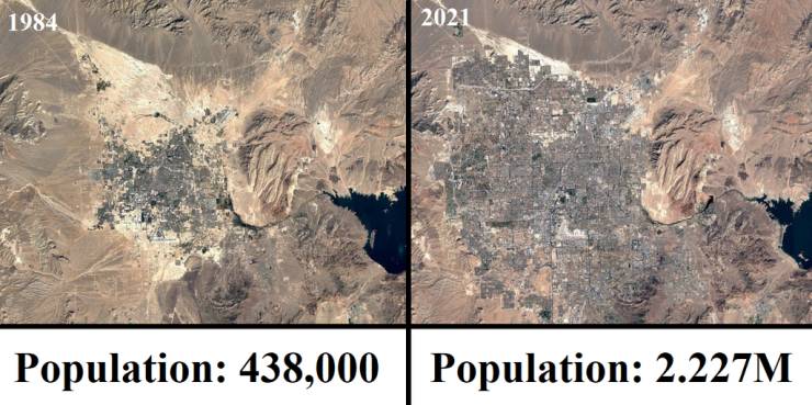
“Las Vegas From 1984-2021”
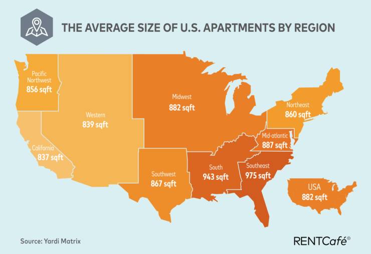
“Average Size Of US Apartments By Region”
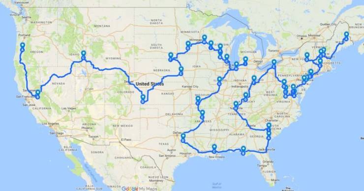
“The Most Efficient Route Between Every Springfield In The United States”
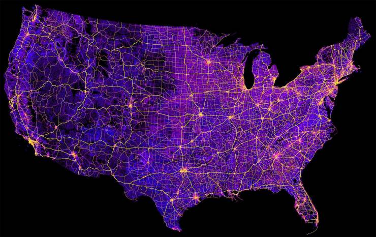
“‘Map Of The United States’ 8 Million Miles Of Roads, Streets And Highways”
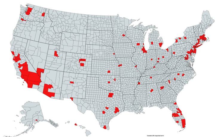
“Red And Orange Areas Have Equal Populations”
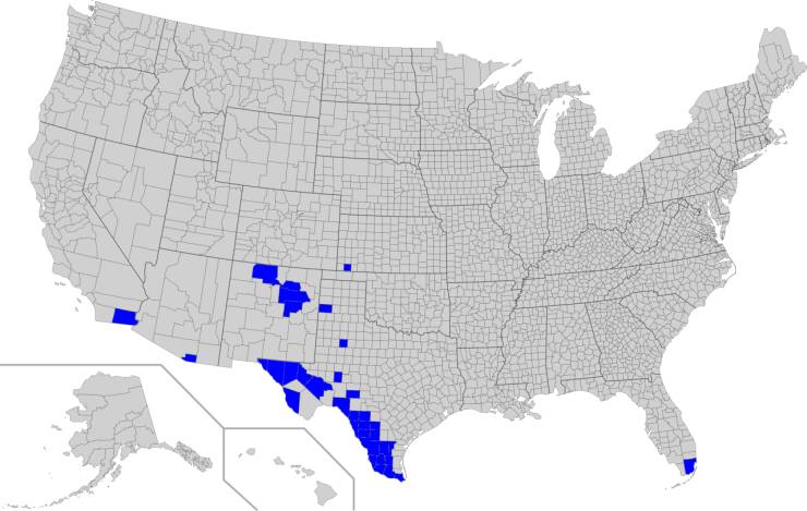
“Counties in the US with a Spanish speaking majority”
“The real size of countries.”
“Where penguins are found naturally in the world”

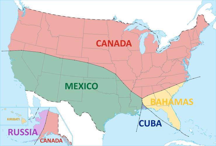
“The nearest country to everywhere in the US”
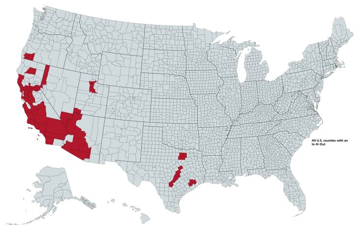
“All U.S. Counties With In-N-Out Burger As Of 2020”
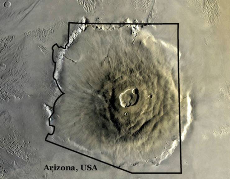
“Olympus Mons on Mars, the largest volcano in our solar system, compared to Arizona.”
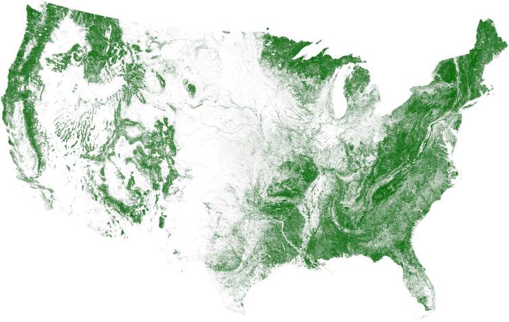
“Tree Cover Map Of The US”
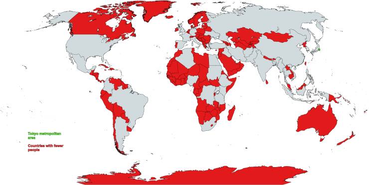
“Countries with a smaller population than the Tokyo metropolitan area”
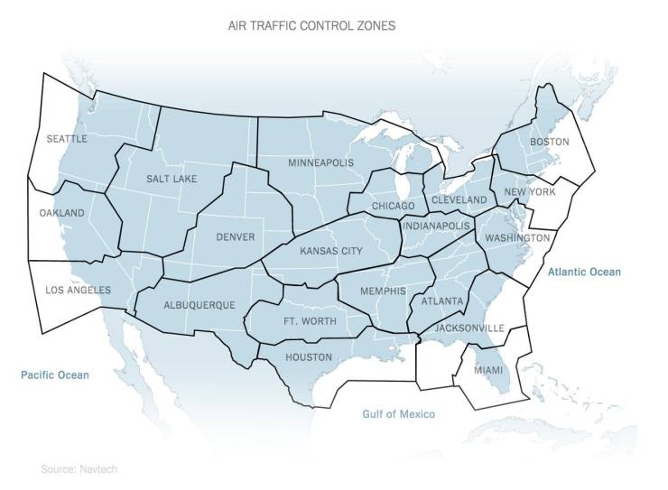
“Air Traffic Control Zones In The USA”
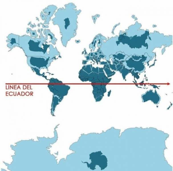
“Light blue is a map as we know it and dark blue is the actual size of each country”