 Barnorama All Fun In The Barn
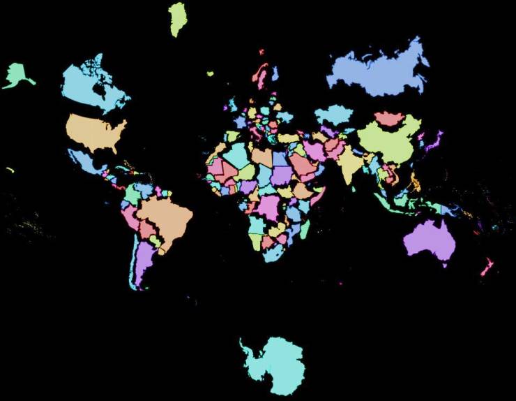
“The real size of countries.”
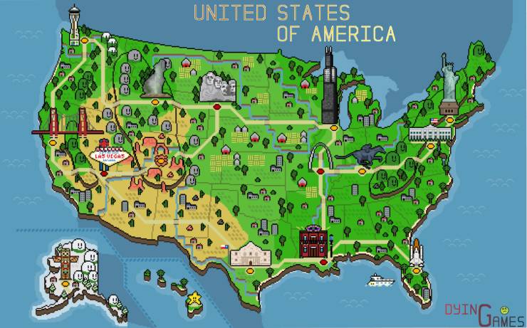
“I made a retro pixel map of the USA! Tried to include some of the iconic monuments/locations that resonated with me.”
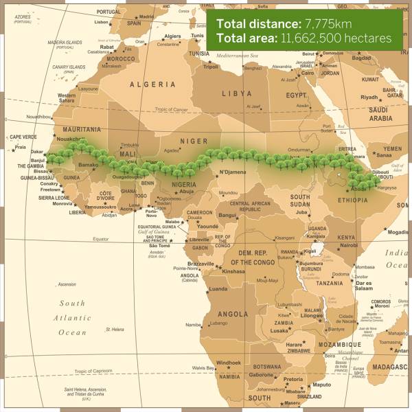
“To combat the threat of desertification of the Sahel (the region immediately to the south of the Sahara), the African Union is leading an initiative to plant the Great Green Wall, a 7,775 km (4,830 mi) belt of trees crossing the entire breadth of North Africa”
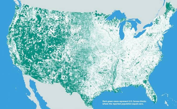
“Where the United States is Uninhabited (the green)”
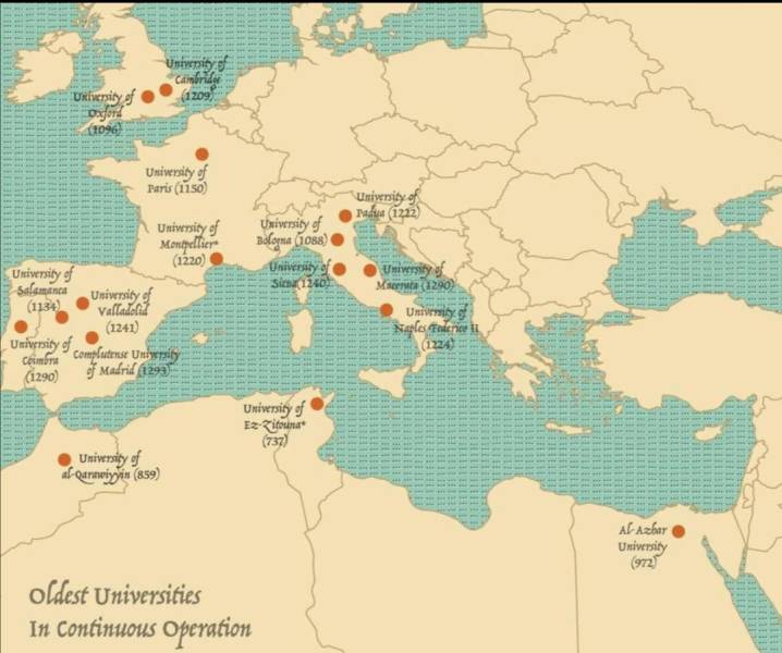
“The oldest universities in continuous operation.”
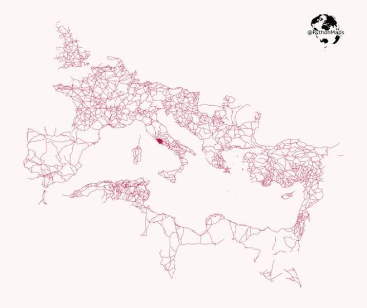
“All roads lead to Rome. This map visualizes the famous roads built by the Roman empire. I have removed the land to highlight how far this empire spread its infrastructure.”
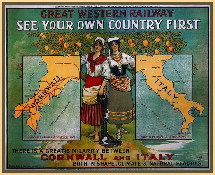
“This 1907 British travel advertisement compares Cornwall to Italy.”
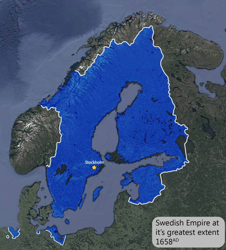
“The Swedish Empire at its height.”
“A map of the world but it’s just the time zones.”
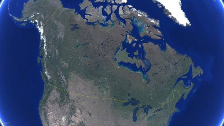
“You can just squeeze UK in Canada’s Hudson Bay.”
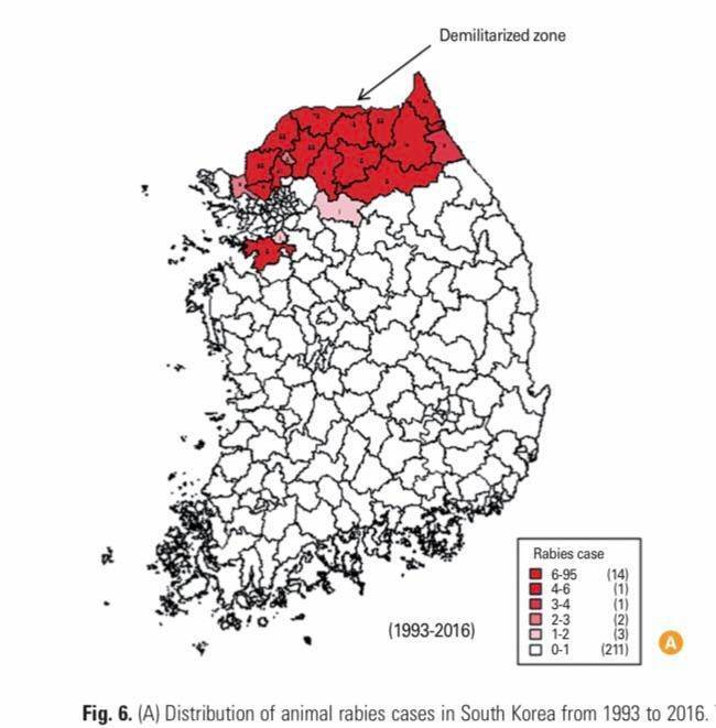
“South Korea is one of the few developed countries that still reports rabies cases (albeit extremely low numbers—no human infection since 2004 and no animal infection since 2014). Officials blame unvaccinated animals from North Korea crossing into the south through the porous DMZ.”
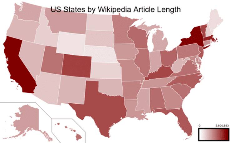
“US States by Wikipedia article length.”
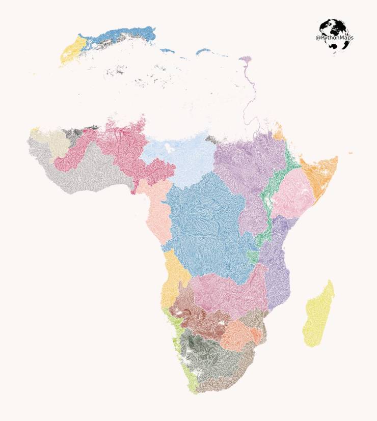
“Here are all of the rivers and waterways in Africa, colored according to the major hydrological basins they are part of.”
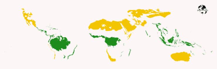
“Tropical rainforest vs Desert! This map shows the global distribution of tropical rainforests and deserts (I have excluded polar deserts!)”
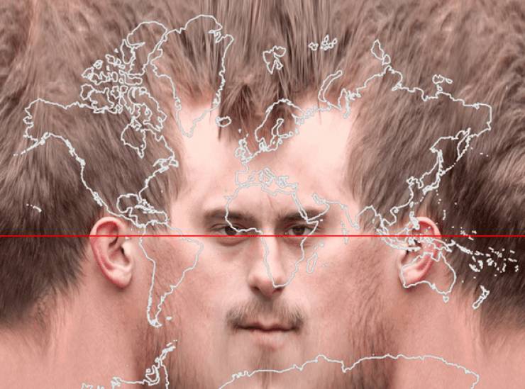
“Treating a human head the way a globe is treated by the Mercator projection.”