 Barnorama All Fun In The Barn
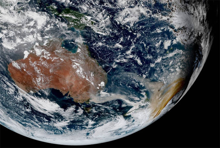
The Himawari-8 satellite photographs the Western part of the Earth once every 10 minutes
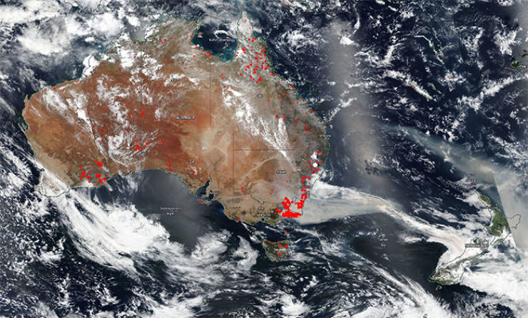
Australia’s bushfires and their smoke plumes are now easily visible from space
After an abnormally long and expansive drought, the fires have spread over vast areas of the country
It’s hard to wrap your head around the devastating scope of the fires
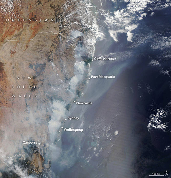
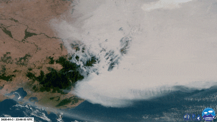
The smoke plume is now the size of half of Europe
And it’s traveling further, clouding up the skies in New Zealand and Chile
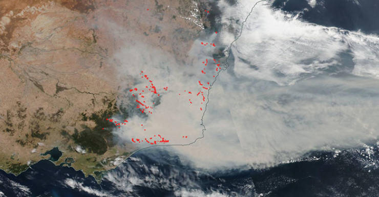
As of January 6th, 69 of 136 fires burning across New South Wales are still not contained
Roughly 23,000 square miles of Australia have been burned
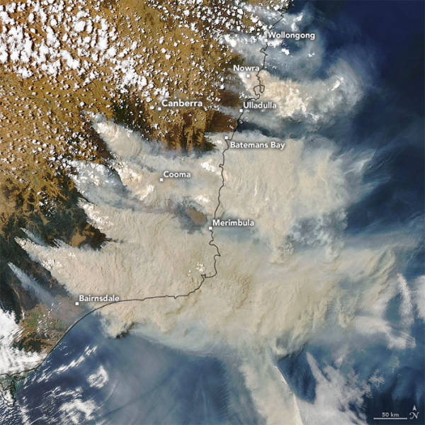
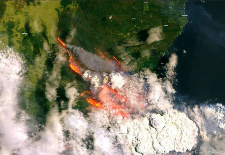
This satellite view of the fire in Bateman Bay, Australia was captured on New Year’s Eve
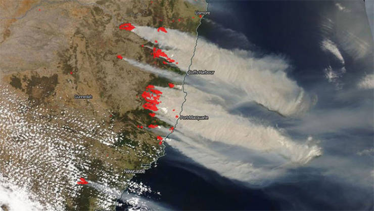
And this is the Himawari-8 satellite’s view of the bushfires and smoke clouds on January 2
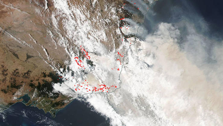
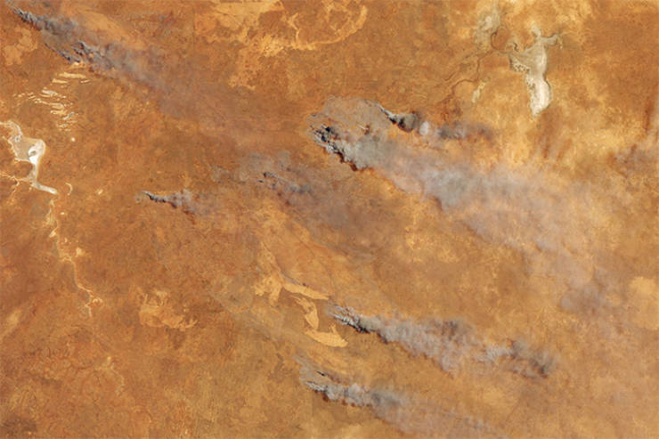
Here’s a near-infrared view of eastern Australian hotspots of bushfires on November 7

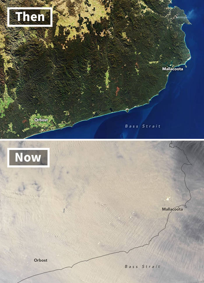
This is a comparison of the same area in July 2019 and January 2020