 Barnorama All Fun In The Barn
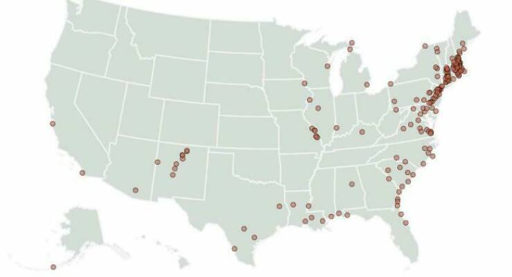
“Map Of Still Inhabited Cities Older Than The USA In The USA”
“The Route I Drove Around Africa. 53,500 Miles Through 35 Countries. It Took Me 999 Days”

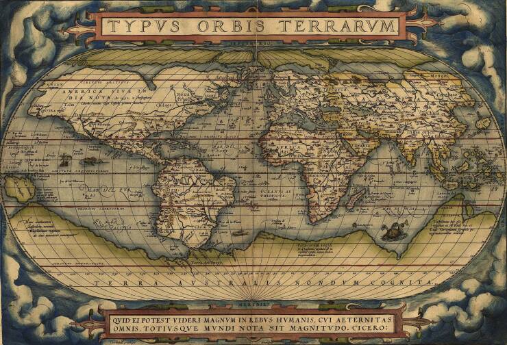
“The Theatrum Orbis Terrarum (Or “Theatre Of The World”) Is Considered To Be The First True Modern Atlas In 20 May 1570″

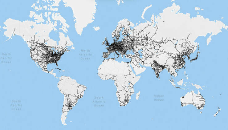
“Map Of World Railway Network, Wikipedia”
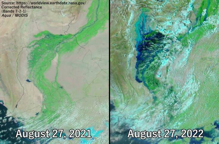
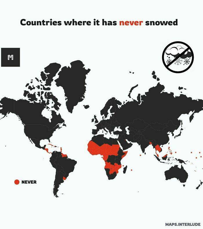
“The Insane Scale Of The Ongoing Pakistan Floods Visualized – Sindh Province Comparison August 27, 2021 vs. August 27, 2022”
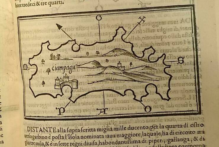
“First Ever European Map Of Japan”
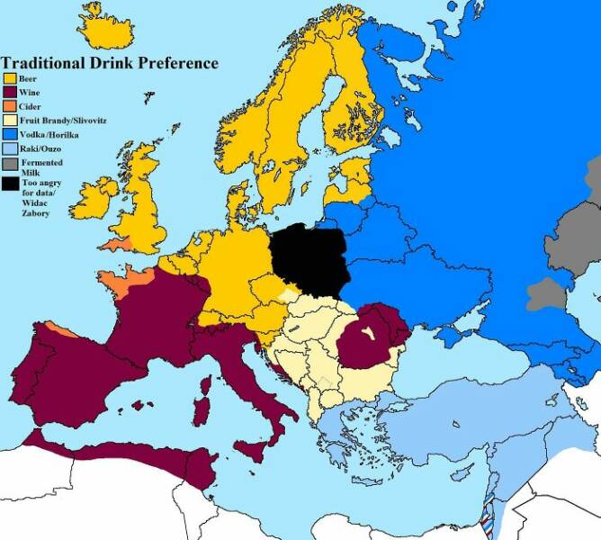
“V3.0 Traditional Alcohol Preferences Across Europe According To Mostly Reddit Comments”
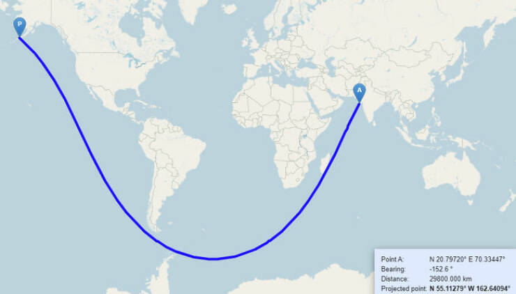
“Without Touching A Single Piece Of Land, It’s Possible To Sail From India To The USA In A Completely Straight Line”
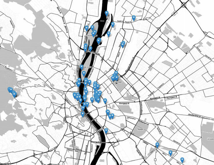
“Map Of Public Spots In Budapest Where Adult Videos Were Shot”
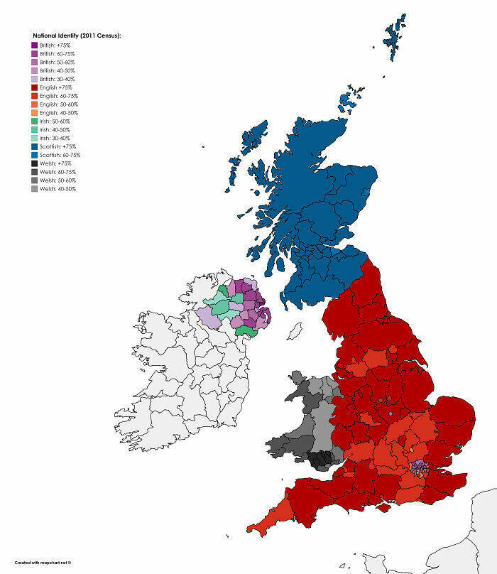
“National Identity In The UK From The 2011 Census”
“The Empire Of Japan At Its Territorial Height (January Of 1943)”


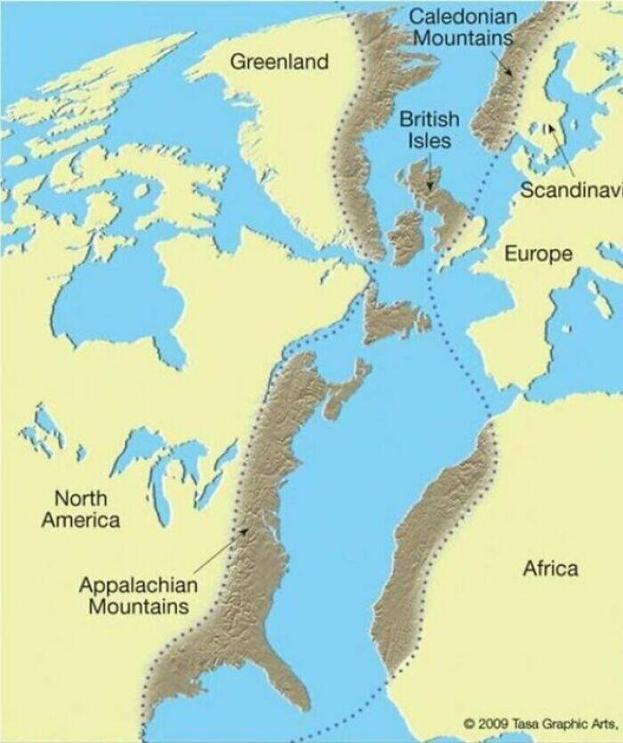
“The Scottish Highlands, The Appalachians, And The Atlas Are The Same Mountain Range, Once Connected As The Central Pangean Mountains”
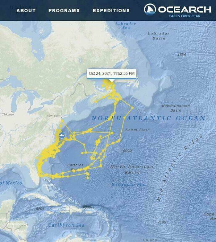
“Shark With Gps Paints A Shark On The Map”
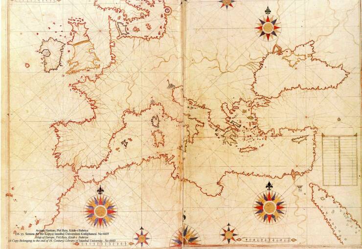
“This Map Was Drawn By Turkish Sailor/Cartographer Piri Reis In 1513”
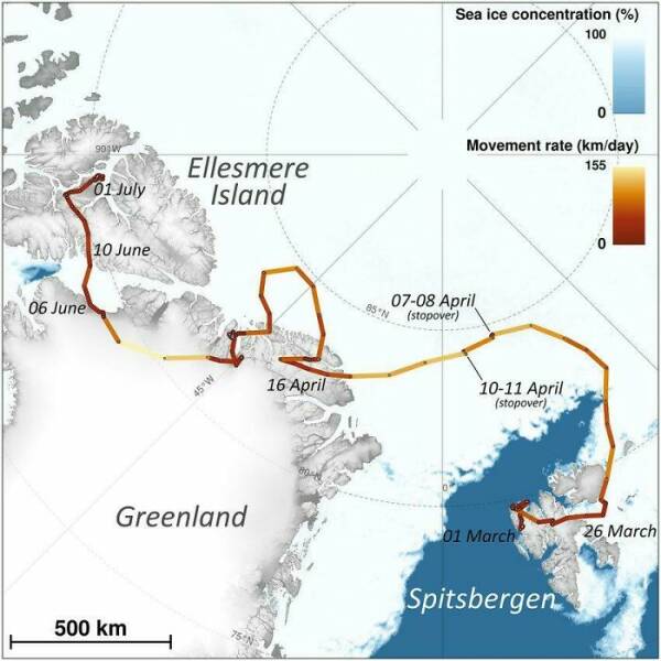
“The Incredible Journey Of An Arctic Fox Who Walked From Norway To Canada In 2018”
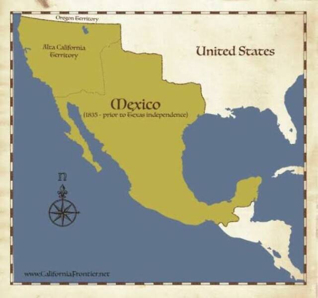
“Imagine What Would Happen If Some Mexican President Wanted To Restore The Country’s Original Borders, Before The American Invasion”
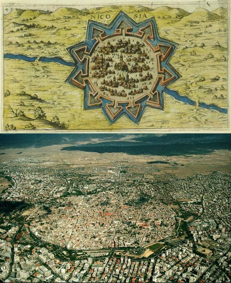
“A 16th Century Map Of Nicosia, Cyprus And The City From Above Today”

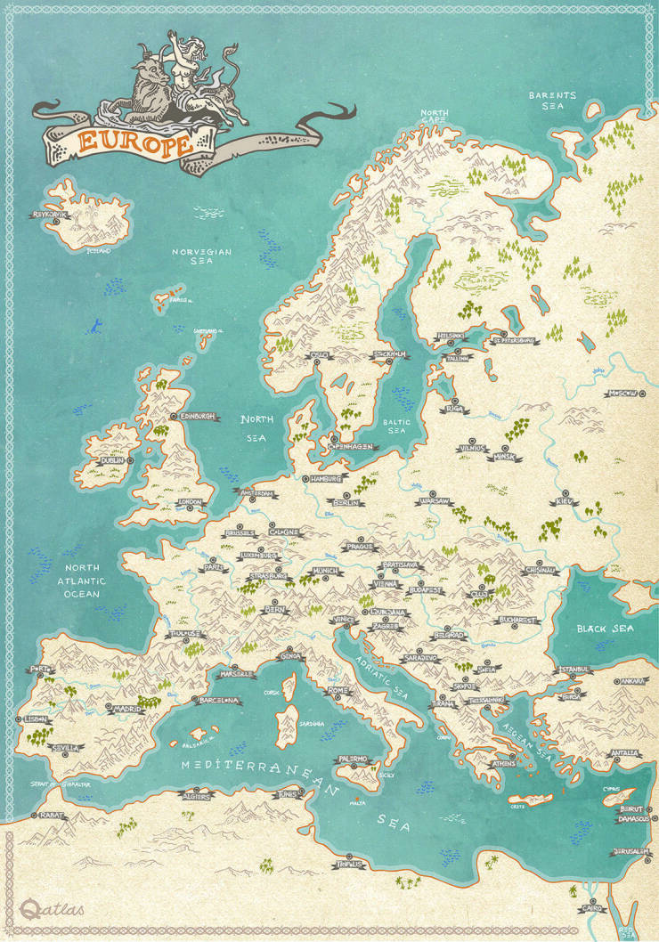
“My European Hand Drawn Line Art Fantasy Style Map”
“This “Where Are You From” Map At The Aurora Museum In Reykjavík Iceland”
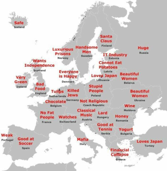
“Japanese Stereotypes Of Europe”
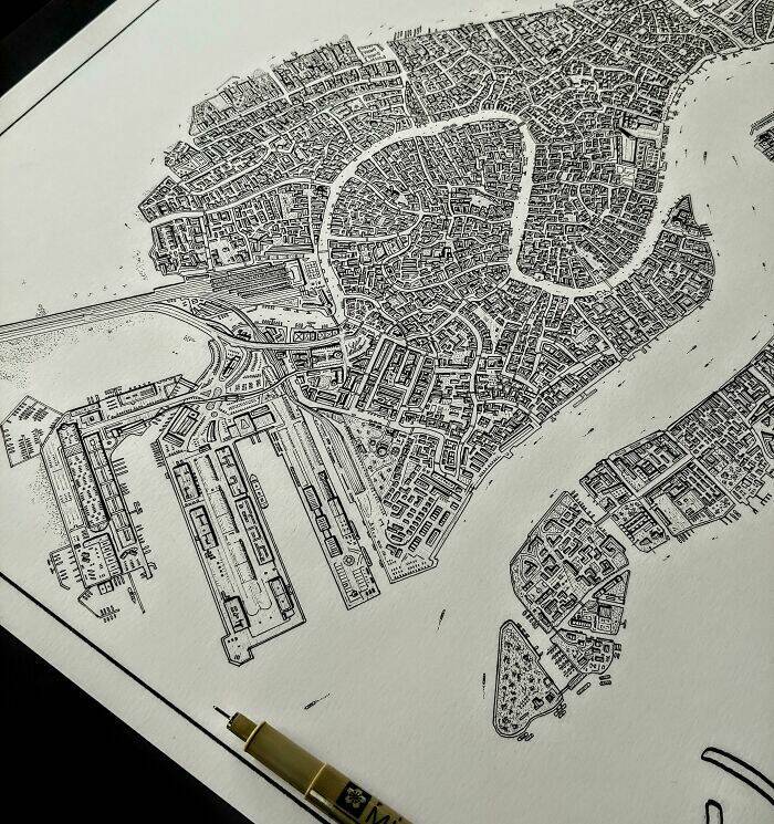
“Hand Drawn Map Of Venice Italy Nearly Completed”
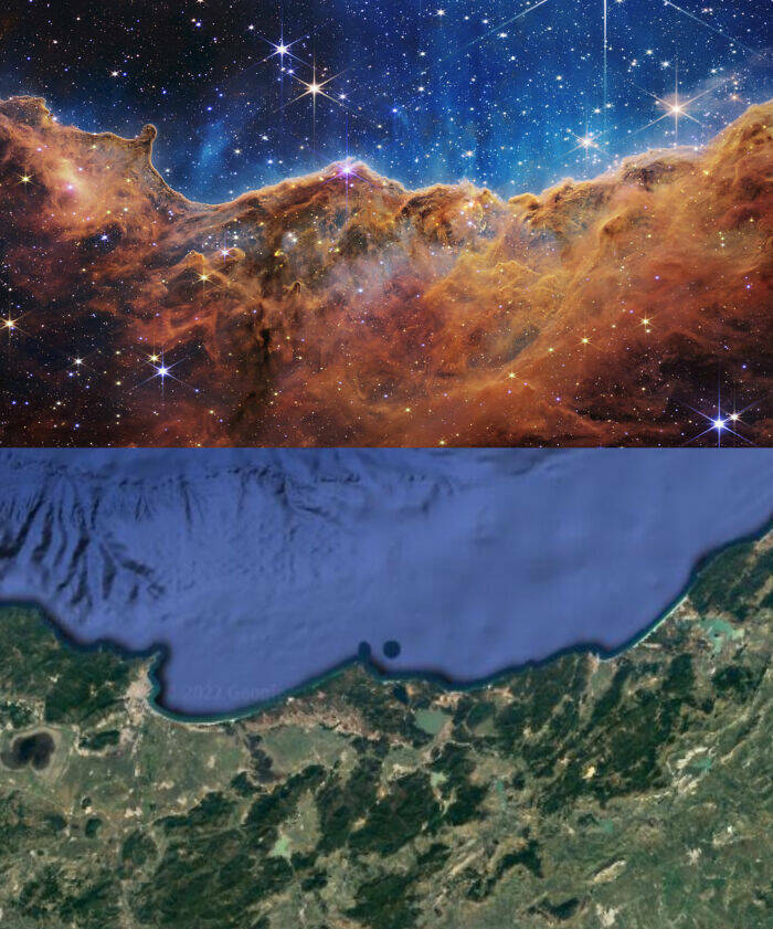
“Trending Now In Algeria : Image Of The Carina Nebula From James Webb Space Telescope Matching The Eastern Coast Of Algeria”
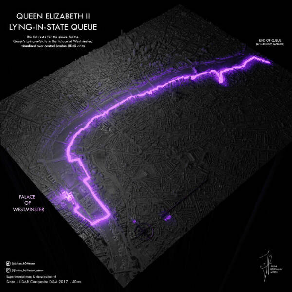
“Queue For Queen Elizabeth II – Visualisation”
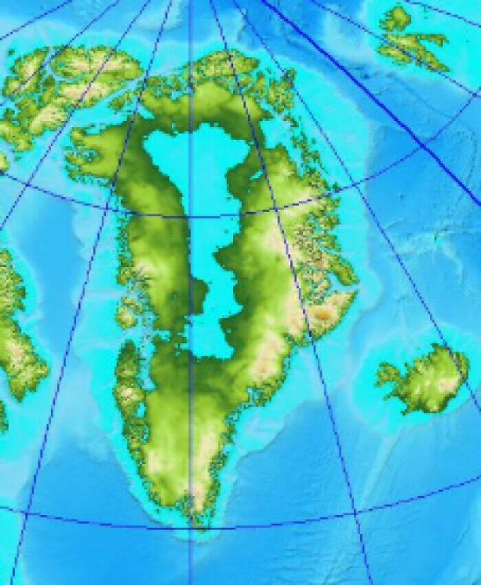
“Greenland Without Ice Would Reveal An Enormous Lake Right In The Center Of The Landmass”
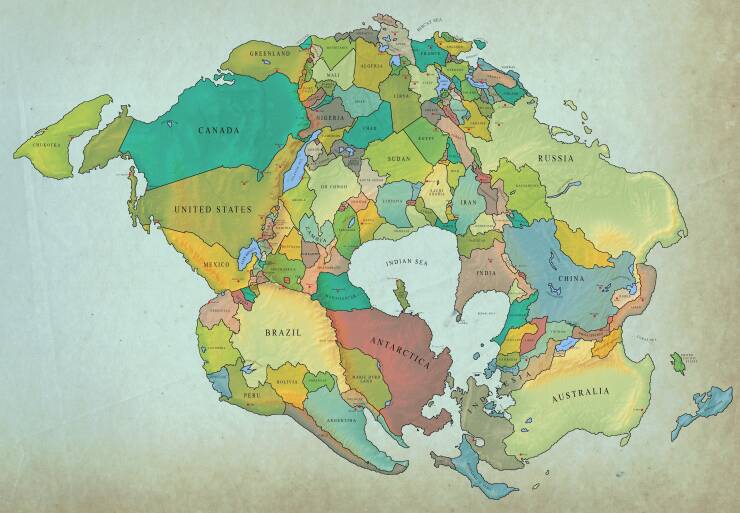
“How Earth Will Look With Current International Borders In 250 Million Years”

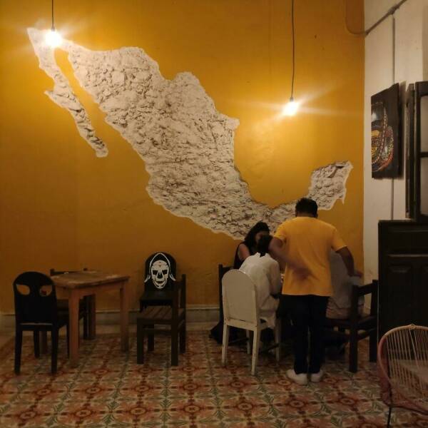
“A Map Of Mexico Carved On The Wall Of A Yucatan Bar”
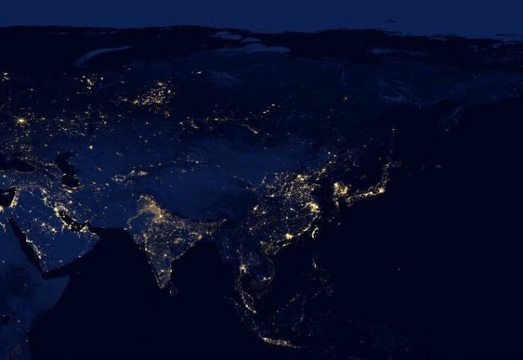
“The Continent Of Asia At Night”
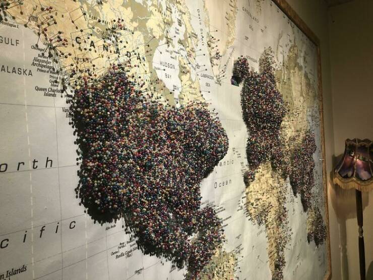
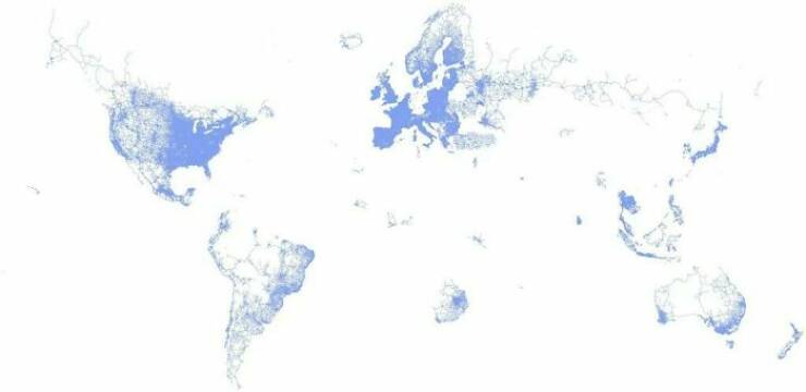
“The World According To Google Street View”
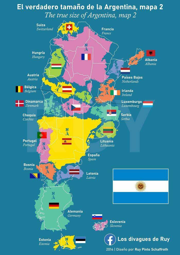
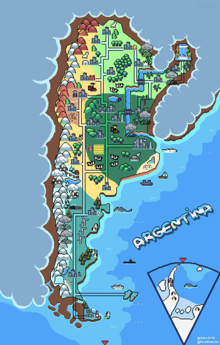
“Pixel Art Map Of Argentina”
Credits: www.reddit.com
Pixel map of Argentina is wrong. The Falkland Islands are British. The Argies invaded in 1982, and we kicked them out again.